
Coastmix
Coastmix is an educational and planning tool for communities to explore ways to protect coastal areas from flooding.
Across the world, coastal cities like Boston are facing the impacts of climate change as sea levels rise and extreme weather events become more frequent and severe. As the City of Boston implements coastal resilience plans along its entire 47-mile coastline, it has sought creative ways to engage with residents who may be unfamiliar with the diverse strategies to improve coastal resilience. Coastmix was created to serve as an innovative community engagement and education tool not just for Boston residents, but also for researchers, organizers, students, and coastal communities around the world. In Coastmix, users can replicate a real-world coastal environment and modify it with possible design features to protect the surrounding area from flooding.
The Office of Climate Resilience and the Office of Emerging Technology have launched Coastmix, an open-source tool that lets people visually design and explore ways to protect coastlines from sea level rise. Coastmix can empower community members, educators, students, practitioners, and advocates to communicate coastal resilience strategies in and beyond Boston. Coastmix is built using the same interface as Streetmix, a popular transportation planning tool, and was created in partnership with the developers of Streetmix.
-
Build Your Waterfront

BUILD YOUR WATERFRONT
ABOUT COASTMIX
Coastmix was created to serve as a community engagement and education tool that enables users to explore ways to design coastal environments to withstand the impacts of sea level rise and storm surge. It is intended to demonstrate the opportunities, space constraints, and trade-offs of adding vertical and sloped flood protection strategies that can prevent water from overtopping a coastline. Some flood protection strategies users may create could include sloped berms, vertical seawalls, raised coastal walkways, elevated roadways, and nature-based strategies, like dunes and marshes.
Coastmix can illustrate the challenge of including flood protection, public amenities, transportation infrastructure, and open space all together, particularly as sea level rise increases over time. The friendly, easy-to-use platform allows users - such as community members, educators, students, and practitioners - to create and edit waterfronts in real time.
HOW TO USE COASTMIX
Tutorial:
The first time you launch Coastmix, a Tutorial and Practice Scenario pop-up will appear to guide you. If you ever need to revisit these, click “Help” on the top toolbar and select either “Coastmix Tutorial” or “Coastmix Practice Scenario.”
Features:
- Environment Editor: In the bottom right corner, click “Environment Editor” to change the appearance of the sky and select the weather, including rain or snow.
- Coastal Flooding Controls: In the bottom right corner, click “Coastal Flooding Controls” to set the sea-level-rise timeframe (Current, 2030, 2050, or 2070). You can also add or remove Storm Surge, which increases water levels further due to wave action.
- Environment Size: Change the width of the overall environment by clicking on the "Change street width" feature under the title of your Coastmix and selecting "Different width."
- Palette: Drag and drop elements into your Coastmix from the bottom palette, including flood protection strategies, people, public realm amenities, transportation infrastructure, and more. Many of these can be customized by hovering over the element after it is added. You can also rename the element by hovering over it and clicking on its default title.
- Waterfront Templates: Click “New waterfront” in the upper right corner to choose from a preset environment, including an empty waterfront you can build from scratch or preset examples such as berms, dunes, floodwalls, and more that you can modify.
- Guidebook: On the top toolbar, click “Help” and select “Guidebook” for a user guide that includes educational information about street design elements, coastal resilience, and more.
Functions:
- Width: Hover over an element to increase or decrease its width.
- Height: Hover over an element to increase or decrease its height. If sea level rise and storm surge are enabled, increasing the height of an element may block flooding.
- Slope: Hover over an element and toggle the slope on or off. If Slope is enabled, you can increase or decrease the height of each side to adjust the shape of the slope.
Coastmix Examples
Berm
A berm is a raised, elongated mound of soil constructed to act as a barrier against water.
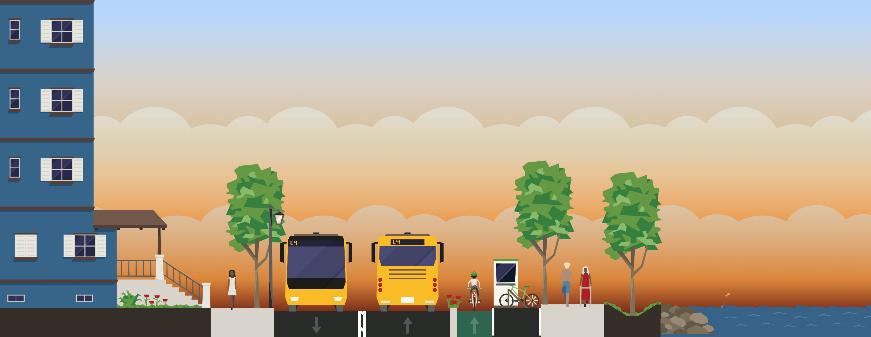
Raised Roadway
A raised roadway is a street that has been built above the base flood elevation to block flooding.
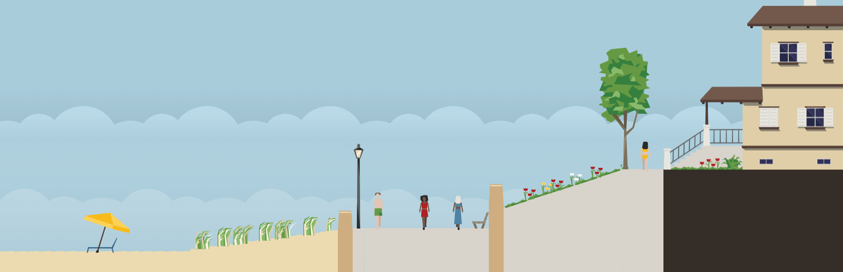
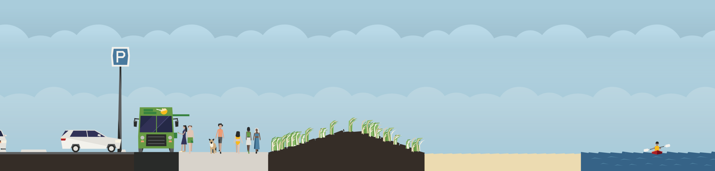
Sand Dune
Sand dunes may be created along beaches to prevent water from reaching further inland.
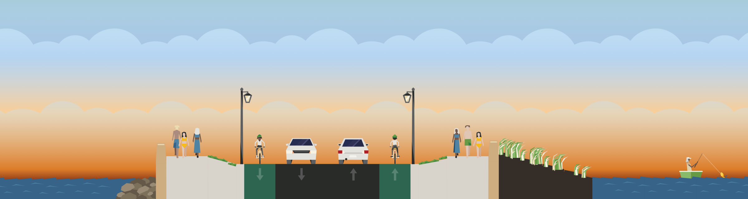
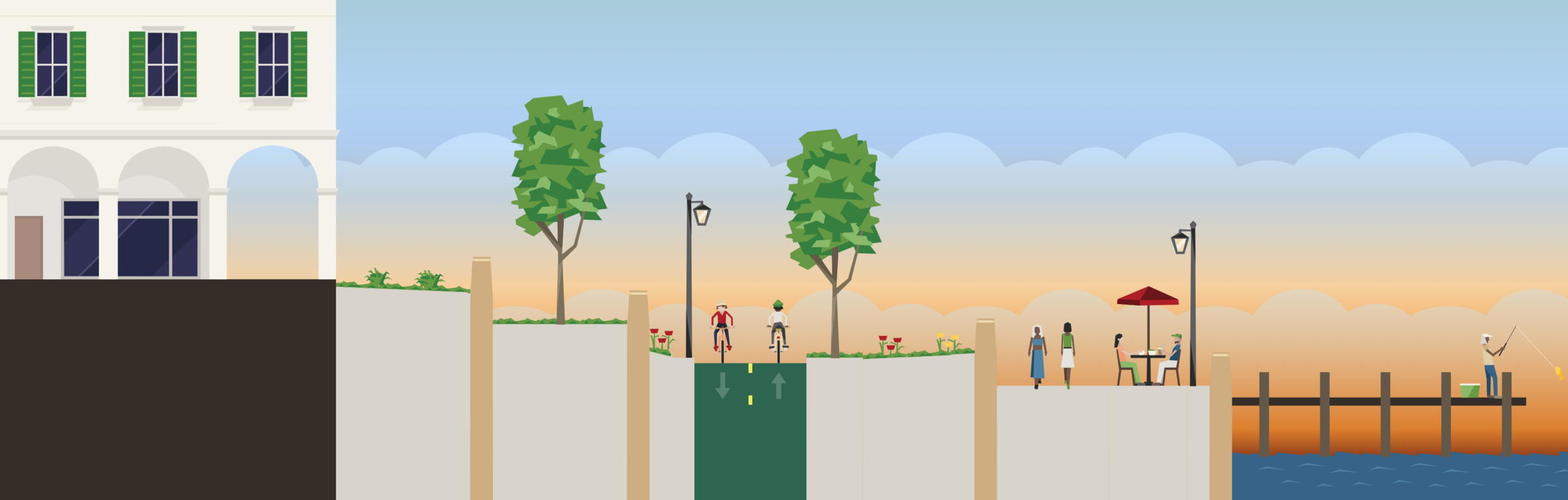
Seawall with Harborwalk
A seawall separates the land from the water and may have public walkways built on top.
Terraced Landscape
Berms and marshes can created nature-based approaches between land and water.
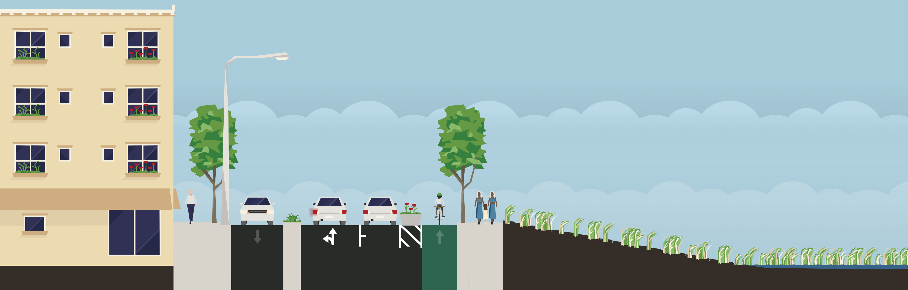
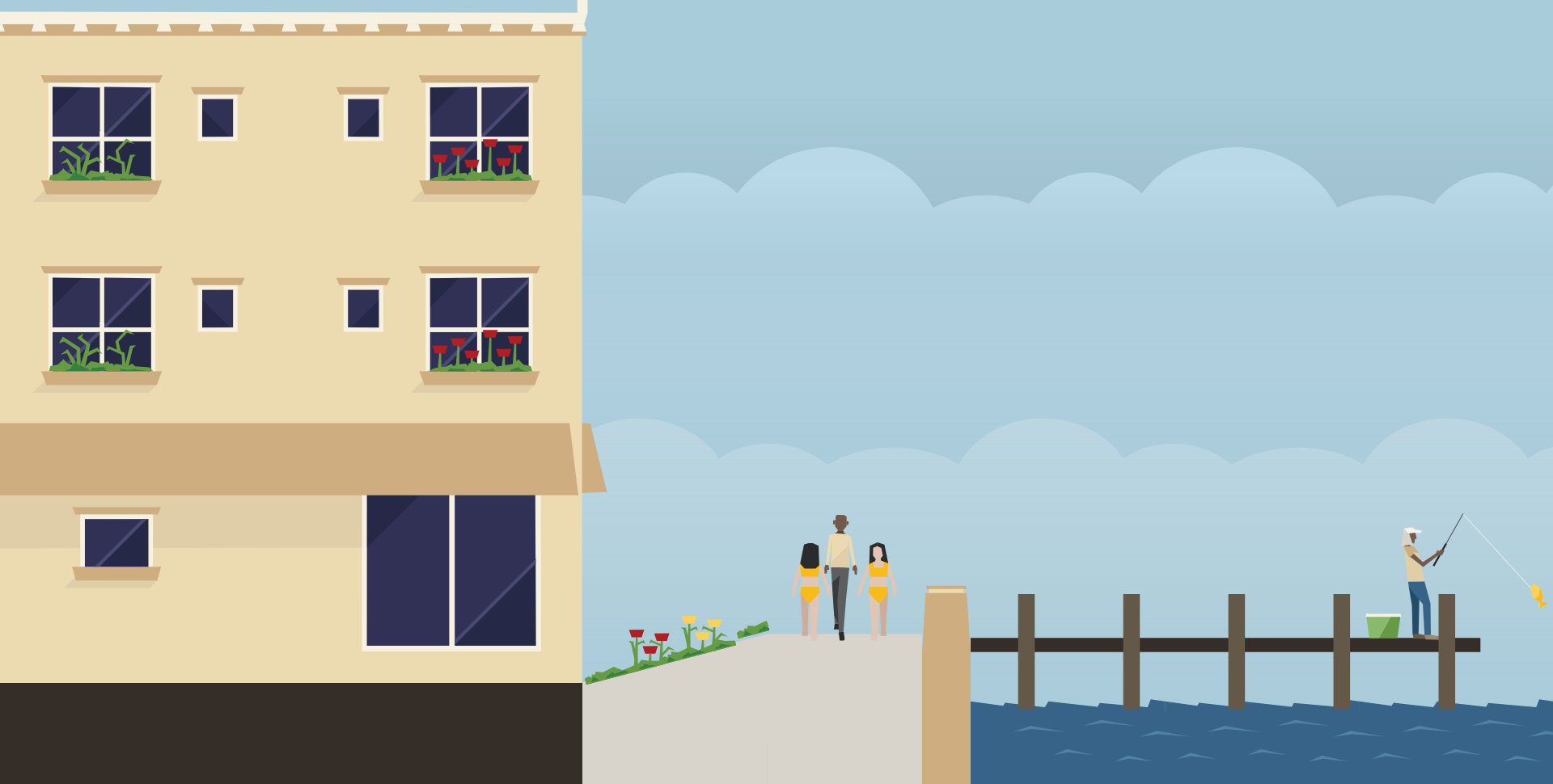
Vertical Floodwall
A vertical floodwall is a flood protection measure that can be used in areas with little space.
Community Gallery
Are you proud of your Coastmix creation? Send it to us at coastmix@boston.gov! Selected submissions may be featured in our community gallery.

SUBMIT FEEDBACK
- Provide feedback within Coastmix: Click on the green comment bubble in the bottom left corner. This will expand a feedback box where you can submit a comment.
- Send feedback via email: Send your feedback to coastmix@boston.gov.
WHAT IS COASTAL RESILIENCE?
Coastal resilience is the ability of human and natural coastal systems to prepare for, absorb, recover from, and successfully adapt to hazardous events (like hurricanes and storm surges) and long-term environmental changes (such as sea-level rise and coastal erosion). Coastal resilience infrastructure refers to the systems, structures, and natural habitats designed to protect shorelines and communities from coastal hazards.
- To learn more about coastal resilience, check out the Coastmix Guidebook under "Climate Resilience."
- The City of Boston is taking action to prepare for the impacts of climate change. Learn more about the City's coastal resilience work (and broader climate resilience efforts) by visiting boston.gov/climate-resilience.
Frequently Asked Questions
Frequently Asked QuestionsCoastmix has several key goals:
- Provide an interactive platform that enables users to explore ways to design coastal environments to withstand the impacts of sea level rise and storm surge.
- Serve as a community engagement and education tool that can teach users basic coastal resilience and urban planning concepts.
- Demonstrate the opportunities, space constraints, and trade-offs of adding vertical and sloped flood protection strategies that can prevent water from overtopping a coastline.
- Illustrate the challenge of including flood protection, public amenities, transportation infrastructure, and open space all together, particularly as sea level rise increases over time.
While anyone can use Coastmix, the intended audience is for community members, educators, students, advocates, and coastal resilience practitioners. The friendly, easy-to-use platform can serve as a community engagement and education tool that allows users to create and edit waterfronts in real time.
Coastmix is not intended to depict all of the challenges that coastal resilience practitioners (such as urban planners, engineers, landscape architects, coastal scientists, and more) grapple with when developing flood protection strategies in real life, including but not limited to engineering feasibility, cost, permitting constraints, or coastal ecology. The platform aims to teach users basic coastal resilience and urban planning concepts and let them think creatively, without the influence of real-world limitations.
Yes! Coastmix is meant to let you illustrate your coastal resilience and waterfront design ideas, so your creations are yours. We kindly ask that you credit Coastmix/Streetmix if you can.
Yes! You can share feedback via email or directly within Coastmix. Please see the section called Submit Feedback for instructions.
Streetmix was created in 2013 by Code for America, a non-profit organization working with governments to deliver services through better technology, as an experiment that bridged urban planning visualization with civic engagement. In 2017, it was released as a standalone, open-source project and is currently maintained by Bad Idea Factory. Today, it is used by thousands of city planners, community organizers, transit advocates, educators and students around the world to prototype, collaborate, and communicate proposed street designs.
-
Build Your Waterfront
